
Szentbékkálla: Kőtenger and local history
Accommodation in Szentbékkálla
Kőtenger and the local history museum give Szentbékkálla a profile shaped by natural and local history. These themes can help guide your choice of accommodation if you want to include landscape and history in your trip to Lake Balaton. The geological highlight lies on the edge of the village; the collection in the local history museum offers a different perspective on the village’s past.
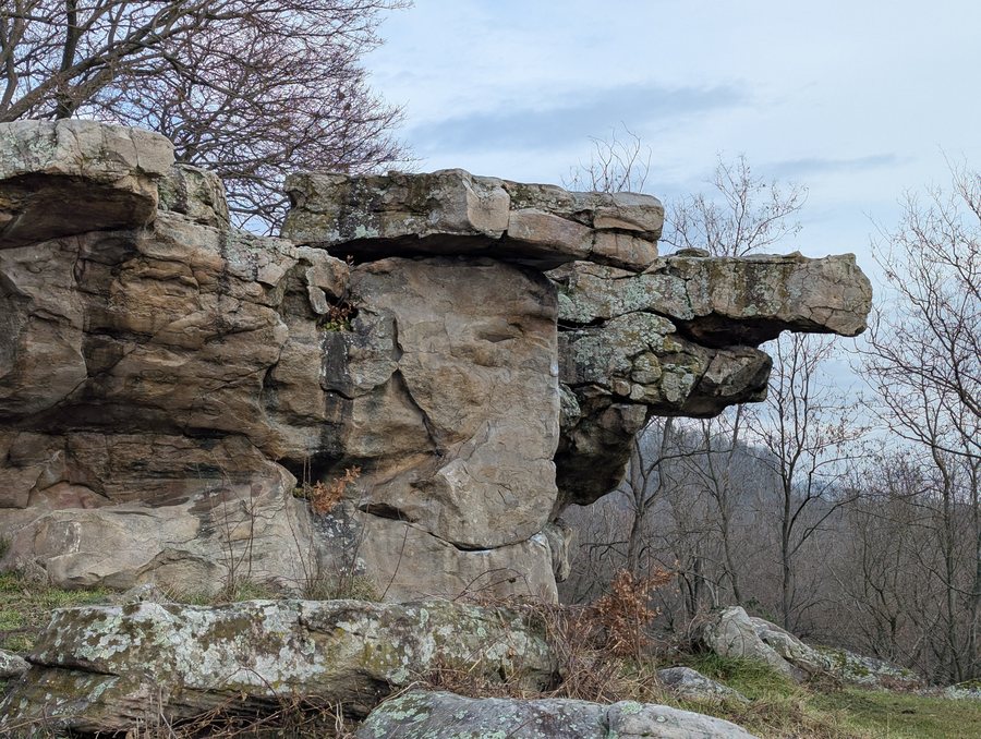 File:Szentbekkalla Kotenger Kelemen-ko (1).jpg
Photo: Artemisia Silence via Wikimedia Commons, CC BY-SA 4.0
Kőtenger and Kelemen-kő
Kőtenger, on the edge of Szentbékkálla, is a lightly wooded area with large boulders and a geological natural monument of the Balaton Uplands. Its best-known rock formation is Kelemen-kő: the uppermost stone slab weighs about 10 tonnes and rests on the rock below at just three points.
A shift in scale helps put the site in context: Kőtenger is the larger area, while Kelemen-kő is a single formation within it. The lightly wooded rocky landscape and the unusual way the stone slab rests on the rock below thus represent two aspects of the geological perspective.
Kőtenger lies along the Országos Kék-túra route and can be reached by bicycle. Its location on the route connects the site to the trail, while bicycle access offers another way to get to Kőtenger. It is advisable to check current conditions before setting out.
Local history museum and village history
The local history museum in Szentbékkálla displays fossils from the Pannonian Sea and finds from Roman times. The collection thus brings together geological history and the human past in a local context. Unlike Kőtenger, whose distinctive features are its boulders and the way Kelemen-kő rests on the rock below, the museum focuses on artefacts from two different periods.
More topics in the broader destination of Lake Balaton - North
The broader destination of Lake Balaton - North provides a distinct regional context for further geological themes. Boat trips are offered in the Tapolcai-tavasbarlang, along with the guided exhibition “Csodálatos karszt” (“Wonderful Karst”). The cave is part of a cave system beneath the town that has been explored to a length of 14.6 kilometres so far. Here, a visitor experience combines with a geological introduction to the karst system. This offers a different perspective from Kőtenger: there, surface boulders define a lightly wooded area, while the Tapolcai-tavasbarlang explores underground formations.
Hegyestű is also part of the broader regional context of Lake Balaton - North. The 337-metre-high mountain lies between Zánka and Monoszló, where the inside of a basalt volcano that was active about 8 million years ago has been exposed. At the viewpoint on the western edge of the quarry grounds, visitors can identify the surrounding hills with the help of a panoramic board. A rock garden displays characteristic rock types of Transdanubia. Within this regional context, Hegyestű offers another geological perspective, distinct from Kőtenger: volcanic history, a quarry and rock types rather than the single rock formation on the edge of Szentbékkálla.
Discover more destinations: Balatonföldvar, Balatonszemes, Vaszoly, Litér, Zánka, Revfülöp, Siofok, Pecsely.

