
Gyulakeszi between landscape and cultural traces
Accommodation in Gyulakeszi
Cultural traces and the surrounding area
Anyone wishing to include Gyulakeszi’s cultural and landscape themes in their travel itinerary can use specific places in the surrounding area as points of reference. The ruins of the Pauline monastery are located in the area surrounding Gyulakeszi. Szigliget vár is also located in the area surrounding Gyulakeszi. Fekete-Kastély is likewise located in the area surrounding Gyulakeszi and adds to the aforementioned local points of reference.
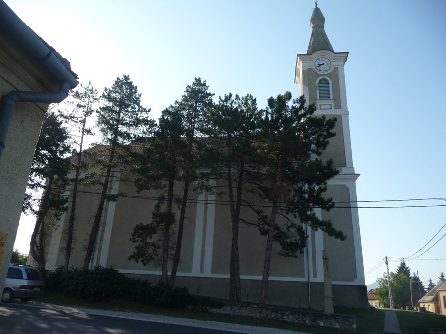 File:Gyulakeszi temploma.jpg
Photo: Pásztörperc at Hungarian Wikipedia via Wikimedia Commons, CC BY-SA 3.0
File:Gyulakeszi temploma.jpg
Photo: Pásztörperc at Hungarian Wikipedia via Wikimedia Commons, CC BY-SA 3.0
The Gyöngyösi Csárda is located in the wider regional area of Gyulakeszi. The geographical scope of the Gyöngyösi Csárda is therefore broader than that of the Pauline monastery remains and Szigliget vár. For planning excursions, this creates a clear distinction between the surrounding area and the more broadly defined regional area. This distinction helps separate a narrower local framework from a larger regional one.
At the cemetery grounds in Gyulakeszi, there are collectible ceramic sherds from the 16th and 17th centuries. The ceramic sherds therefore belong to a clearly defined period of the early modern era. Earthworks constructed during the Rákóczi War of Independence make the site more difficult to survey. For those interested in cultural history, two different levels come together here: ceramics dating from the 16th and 17th centuries and terrain evidence associated with the Rákóczi War of Independence.
At the Roman Catholic cemetery site in Gyulakeszi, the archaeological finds include the foundations of a circular building, bronze fittings and other bronze objects, as well as a Roman brick fragment. The types of finds thus range from structural remains and metal finds to a brick fragment. This provides several factual perspectives for studying the site within the field of archaeology.
The cemetery grounds in Gyulakeszi also contain archaeological remains associated with a Roman settlement. These include a possible villa structure. Traces of a small fortification from the Ottoman period are also attributed to the cemetery grounds. The possible villa structure is therefore associated with the Roman settlement, while the small fortification is assigned to the Ottoman period. The two findings thus belong to different historical contexts. The archaeological traces range from a possible Roman villa structure to a small fortification from the Ottoman period; the ceramic sherds add an early modern period to this evidence.
Landscape points of reference
Badacsony is located in the area surrounding Gyulakeszi. Boncsos-tető is located in the area surrounding Gyulakeszi. Agár-tető is located in the area surrounding Gyulakeszi. Köves-tető is located in the area surrounding Gyulakeszi. Alongside cemetery archaeology, these four landscape references create a second focus in the surrounding area. Landscape and cultural themes can therefore form separate focal points when planning a trip. Badacsony, Boncsos-tető, Agár-tető and Köves-tető add four further named landscape references that complement the geographical framework of the locality.
When planning their own trip, couples, families and small travel groups can treat cultural history and landscape as separate interests for different days. For Gyulakeszi, historical structures, archaeological traces and landscape references can be arranged into different focal areas.
Other places: Vaszoly, Tagyon, Szólád, Balatonfüred, Balatonkeresztur, Tihany, Teleki, Zánka

