
Balatonkeresztúr on the western southern shore of Lake Balaton
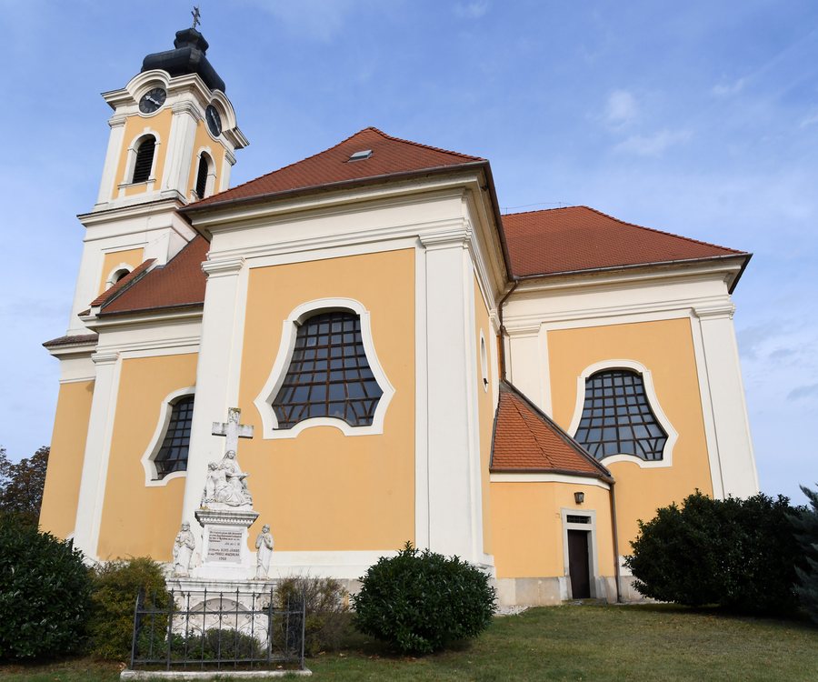 Roman Catholic church in Balatonkeresztúr
At the western end of the southern shore
Balatonkeresztúr is located at the western end of the southern shore of Lake Balaton. For travelers who want to structure their days around the lake and the surrounding region, the town’s location provides a clear spatial framework. Lake Balaton serves as the overarching point of reference alongside the town itself, while the surrounding area can be divided into a nearer and a wider scale. Those who distinguish early between a fixed lakeshore focus and a broader regional radius can formulate their preferences regarding pace and the length of each day as planning considerations. For orientation in the area, Balatonkeresztúr remains the fixed point of reference.
Road 7 along Lake Balaton
Road 7 runs near Balatonkeresztúr along Lake Balaton and turns south at the settlement toward Nagykanizsa. For visitors organizing their stay geographically, this route provides a specific point of reference. The lake, the settlement, and the southern direction toward Nagykanizsa emerge in a clear sequence. Especially for independently organized days away, it is helpful to keep directions simple in wording. The road along the lake and its southern continuation can be given different weight in personal planning. This keeps the road orientation concrete and factual.
The settlement along roads and railway lines
The settlement lies at an intersection of roads and railway lines. This connection is a distinct feature in forming a spatial picture of Balatonkeresztúr. Those considering the town for a stay can keep the lakeshore, road, and railway as separate orientation elements alongside one another. This factual division suits travel planning in which every day does not need to have the same radius.
Points of reference in the nearer and wider surrounding area
The surrounding area of Balatonkeresztúr includes Csillagvár, Fekete-Kastély, and Szigliget vár. In the wider region of Balatonkeresztúr lies Pálos kolostor romjai. The different spatial levels are useful for planning daily activities: the nearer area and the broader regional setting can be considered separately. This makes it possible to organize the points of reference in a travel plan according to spatial scale. It is a useful perspective for travelers who want to deliberately keep their daily radius small or plan within a broader regional framework.
Additional geographical points of reference
Edericsi-hegy, Köves-tető, and Bari-hegy lie in the surrounding area of Balatonkeresztúr. Badacsony lies in the wider region of Balatonkeresztúr. The town’s location gains additional geographical points of reference in the nearer and wider surrounding area. For travelers who deliberately choose the scale of a day during their stay, the distinction between the surrounding area and the wider region offers calm orientation. One day can be devoted to the immediate surroundings, and another to a more distant regional destination. The choice that follows depends on the personal travel plan; the geographical arrangement remains the same.
Other town pages in this overview are Visz, Nemesgulacs, Zánka, Balatonhenye, Balatonszepezd, Aszófő, Ordacsehi, and Gyenesdias.
Check prices, availability, and amenities for your travel dates directly on Booking.com.
View accommodations and offersAdvertisement · Affiliate link to Booking.comPhoto: Pasztilla aka Attila Terbócs via Wikimedia Commons, CC BY-SA 4.0


